
Do you often have the following troubles:
Do not know the current location of the ship or the surrounding sea meteorological conditions, unable to make timely adjustments.
Not knowing the voyage information and performance of the ship, unable to effectively plan the trip and save cost.
Feeling helpless and fearful when encountering bad weather without timely warning and guidance.
If you do, good news! Ninecosmos NIO is to solve your problems.
In order to build a strong maritime security defense line, improve the risk screening capacity and emergency response capacity of the fleet, based on the above navigation requirements, our company has recently launched the self-developed FleetEye mini program.
Based on artificial intelligence numerical forecast optimization technology, this mini program can comprehensively monitor and analyze the fleet by using refined meteorological and hydrological coupling forecast, multi-source heterogeneous data mining analysis and intelligent fusion, providing managers with a clear vision.
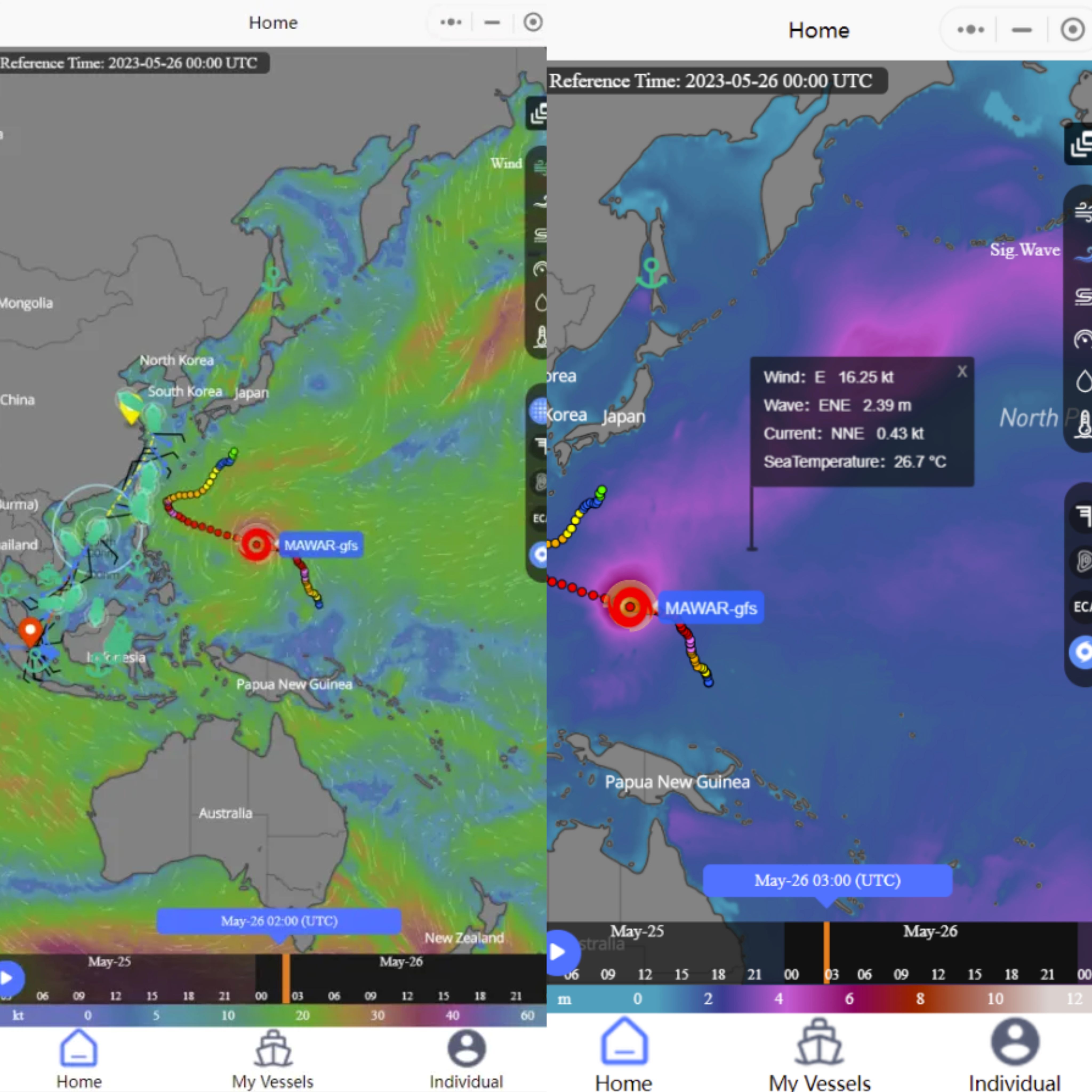
A screen contains all the meteorological and hydrological ship data
Just touch the screen, you can get real-time ship location and sea meteorological conditions, such as ship speed, heading, sea wind, wind speed, wind direction, flow direction, wave height, sea temperature and other data information, everything will be under your control.
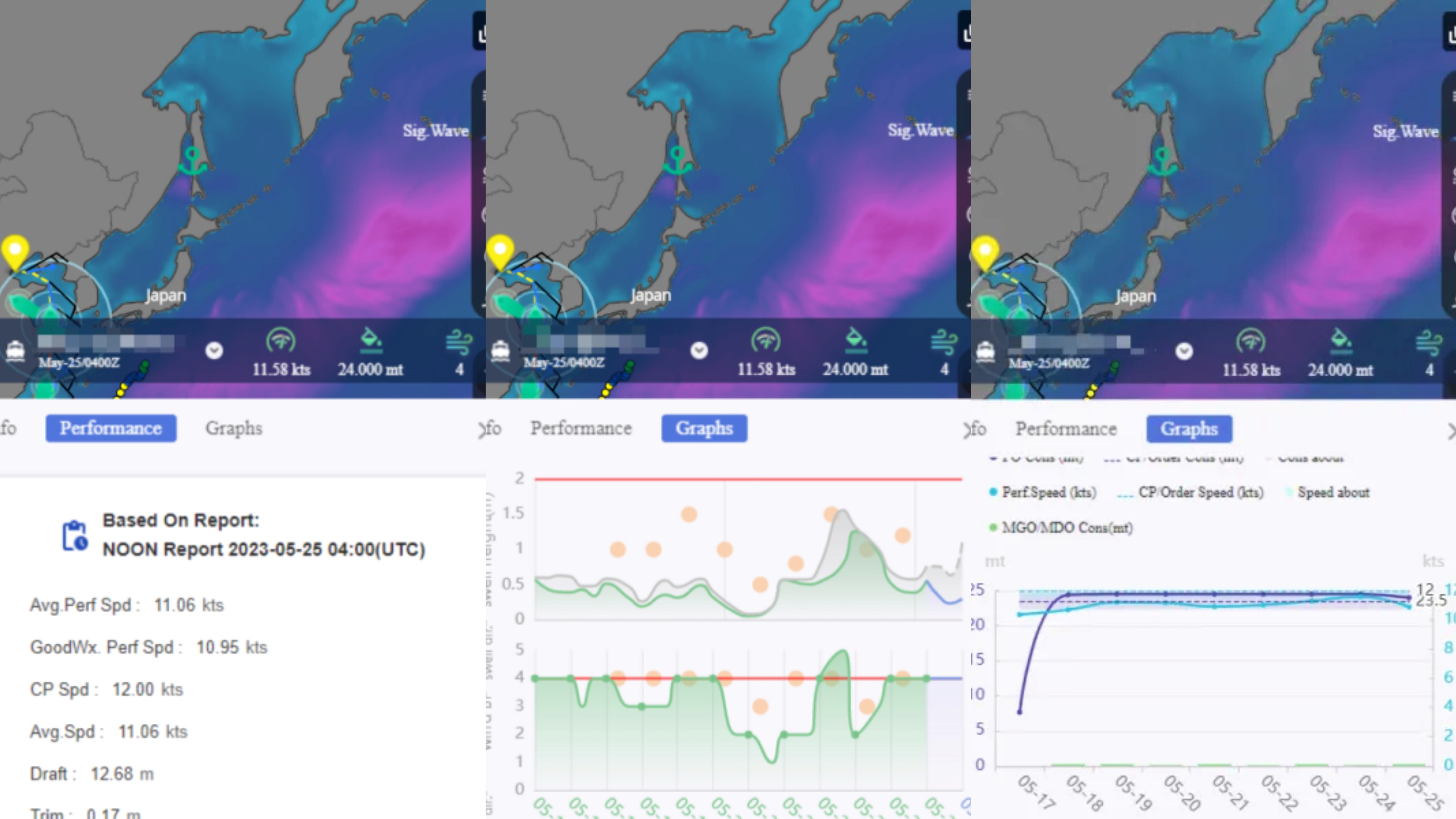
One click away from voyage information and performance data
Relying on the voyage information and performance query function of the mini program, you can clearly understand the history and expected voyage information of the ship you are on, including port of start and stop, mileage, time, fuel consumption, and performance parameters of the ship, such as speed, power, draft, etc., so as to accurately evaluate the real-time performance of the ship, which can support scientific decision-making, optimize the travel route and save transportation cost.
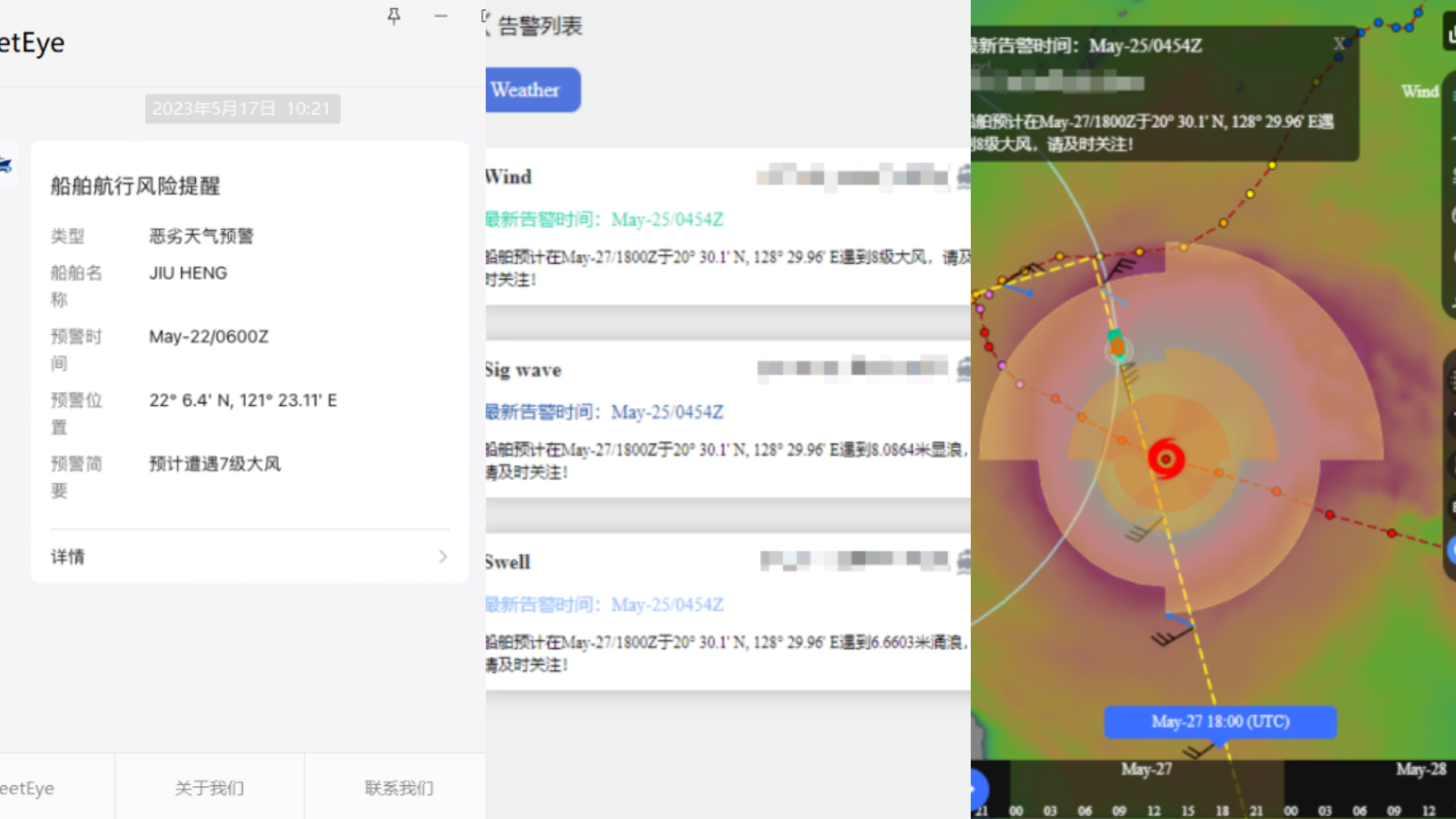
ensure the safety throughout your voyage
You can set the sea area of concern and the meteorological conditions that trigger the warning. Once the system detects the potential risk of bad weather in the sea area where you are or are about to arrive, the system will send you the warning information immediately, so that you can deal with it calmly, avoid risks in time, and maximize the safety of your crew and cargo.
Such rich data resources and practical functions will be presented to you in a concise and beautiful form, without complex installation process and cumbersome settings, you can easily obtain the required information anytime, anywhere, fast, safely and conveniently, offering you excellent user experience.
Looking forward to your use and feedback, we will continue to optimize and improve system services and application scenario functions, improve your satisfaction, and strive to create an intelligent assistant exclusive to you.
Fast track
Home About Technique Forecast Products News ContactProducts
Smart Meteorology Ocean Shipping Atmospheric Environemntal Protection Disaster Prevention and Mitigation Big Data Fusion HPC Intelligent Energy Intelligent Agriculture Smart CityElectronic album

Follow us


 Home
Home Products
 News
News Dial
Dial